» Tracks of "SKIWANDERZENTRUM ZWIESLERWALDHAUS"
Access at start and finish area - follow the blue arrows - easy descent - turn right after 1.6 km (1 mi) - descent towards "Schleicherschwelle" (if you feel insecure, please unstrap your skis) - along the Schleicher creek to the village Schleicher (parking lot, restaurant, Haus zur Wildnis (NP visitor center)) - after 3.7 km (2.3 mi) turn left (here it is possible to reach Kreuzstraßl and Lindbergmühle, restaurant) - easygoing and wavy ascent - back to start and finish area
| Length: | ca. 9 Km (5,5 mi) |
| Marking: | blue |
| Character: | medium |
back
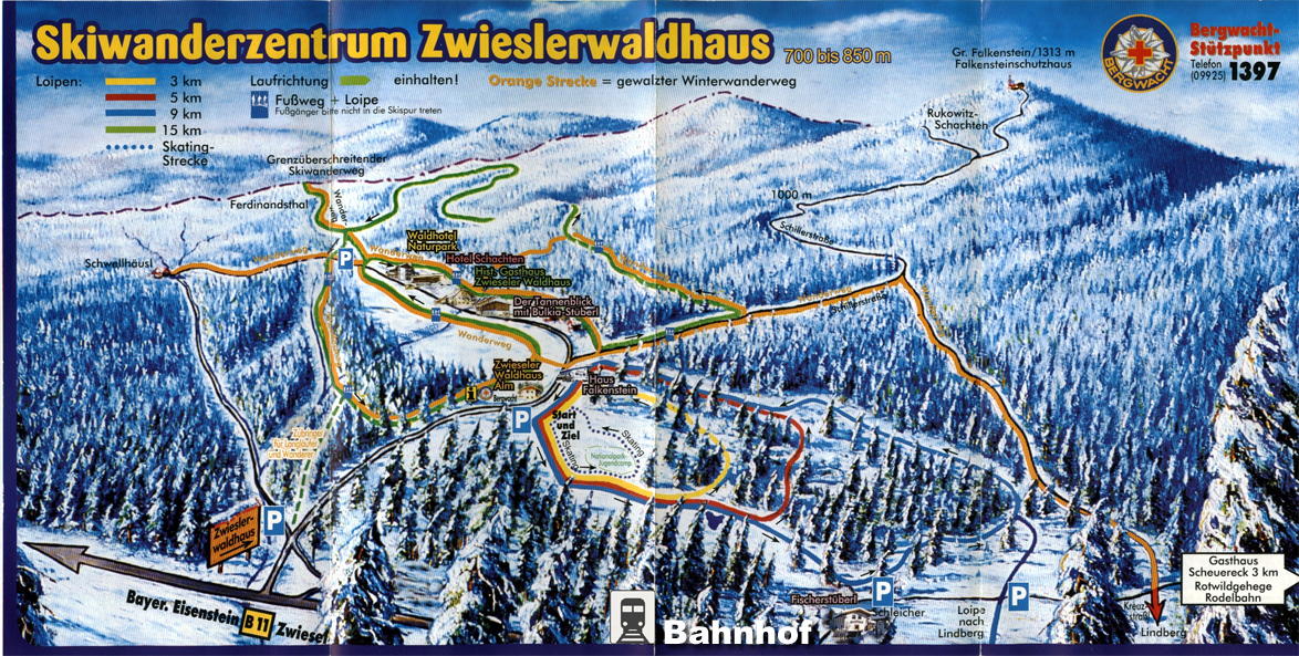
To enlarge click here
Source: Map "Skiwanderzentrum Zwieslerwaldhaus - Bayerischer Wald", ©Steiner Design Verlag