» Tracks of "SKIWANDERZENTRUM ZWIESLERWALDHAUS"
Access vis-à-vis start and finish area on the right side of "Zwieslerwaldhaus Alm" - follow the green arrows - circle Zwieslerwaldhaus till you reach the Schiller parking lot - turn left - Schiller street - turn left after you passed the water elevated tank for Zwieslerwaldhaus - crossing the western hillside until you reach the boundary stone 5/7 (national border) - easy going descent on an historic path - toilets - turn left (if you turn right you reach the border crossing Ferdinandsthal) - after 250 m turn right towards parking lot P2 - cross the street to Schwellhäusl - via "Brechhäuselauweg" and "Heuweg" back to start and finish area. Part of this track is shared with a winter hiking trail. Please respect each other.
| Length: | ca. 13 Km (8 mi) |
| Marking: | green |
| Character: | medium |
backk
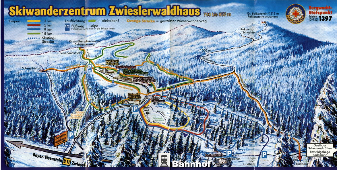
To enlarge click here
Source: Map "Skiwanderzentrum Zwieslerwaldhaus - Bayerischer Wald", ©Steiner Design Verlag